Translate

Wednesday, May 20, 2015

The Oregon Trail Interpretive Center on to Idaho


Right in Baker City, Oregon is the Oregon Trail Interpretive Center.  Such a wonderful resource for all things to do with the Oregon Trail.

We were remembering having the Oregon Trail program for one of our early computers.  I think the schools also used it for American History.


The Center sits atop a hill.  From here you can see the Blue Mountains.  The Emigrants had just crossed the Snake River and could see this next challenge across the valley.  Outside, you can still see the ruts from the 300,000 travelers seeking new land in the Oregon Territory from about 1840 to 1869.

Each couple was looking forward to the 320 acres of free land, guaranteed by Congress.


Earlier, it was Lewis and Clark who proved that a land route was possible to the Pacific Ocean.  But it took John Fremont to find the South Pass through the Rocky Mountains that allowed wagons to travel the entire route.

Not easily, they needed smaller wagons than the 16 foot Conestoga freight wagon.  There would be many rivers to float across and steep mountains to wrangle the loads up and down.


Oxen were the animal of choice to pull the heavy loads.  They could eat almost anything, were strong, and , in an emergency, could be used for food.  If they made it all the way, they were a useful farm animal as well.

Contrary to this picture. most travelers walked the entire 2,000 miles from Independence, Missouri on the Missouri River.  The wagons were loaded with tons of food and necessary belongings.


Easy there, Jan!

We hope to see live Bison again , shortly.
The early Emigrants saw thousands of bison on the plains.  They provided food for part of the trip.

All through the Center are quotes from the many journals about the life along the way. One story recalled how the women were reluctant , when there was no wood on the plains, to handle the buffalo chips needed for the fires.  It did not take long before they were handling them readily each day.
What was that? Oh.  Buffalo chips are dried buffalo dung (poop) Would you barbecue with buffalo poop?
It was not an easy trip.  15 miles a day average.  Disease and accidents claimed over 30,000 lives.   But still, what an interesting part of American history.  The expansion made it easy for  the U.S. to add the Oregon Territory with little complaint from Great Britain.  Without this great  migration, we might still be east of the Missouri River.


From Baker City, Jan and I head southeast on Interstate 84.  It's a short drive to Farewell Bend State Park.  This is a very comfortable Oregon state park located on the Snake River.

This is the spot where the Emigrants were finally able to cross the Snake River.


The Snake River is a huge river that more or less  starts in Wyoming in southeastern Yellowstone National Park , travels south and east to Boise, Idaho and then north(making the border line between Idaho and Oregon, and then northwest to join the Columbia River and eventually empty in the Pacific Ocean between Oregon and Washington States.


This map shows the strange route for the Snake River to reach the Columbia River.

This is the same river that we saw at the Grand Tetons near Jackson, Wyoming.


Our backyard in Farewell Bend is visited daily by a herd of cattle.  We see a lot of these herds, grazing on hundreds of acres.  This herd numbers about 30 to 40 .


As indicated before, we are right on the Snake River.  The hills across the way are in Idaho, our next destination.


We are fairly close to Boise, Idaho. But we opt for a quieter route and take Route 201 from 84 to Route 95 north.


Along the way are beautiful farms.  Some are growing hay, some cattle, some horses, and some sheep.
Every now and then some fields of those famous Idaho potatoes are showing.


Jan and I have found a good review for a campground on the Snake River.  It is 30 miles northwest of Cambridge on route 71, a very winding mountainous road.


Some sheep.


And also a group heading off on a horseback ride.


And in the valleys, some beautiful farms.

And the end of our trail brings us to Woodhead Park Campground.  124 sites, run by Idaho Power Company.

The power company has three dams on the Snake River.  The first above here is the Brownlee Dam and this is on the Brownlee Reservoir.


From above the campground, you can see the Brownlee, or at least a part of it.  The reservoir is 58 miles long which makes it a great attraction for outdoor sports.


The boat launch at the campground attests to the popularity.  Even with a 30 mile drive from the nearest town, there are about thirty boat trailers here on a weekday.

And the action at the fish cleaning station indicates that the fishermen are doing quite well.


Large trucks bring fish from the power company hatcheries.  In this case they are Salmon that will migrate out to the ocean and then back in 7 years to lay eggs. There are some readers who will be interested in this link to the Idaho Power program. Idaho Power Hatchery Program


This Sheriff's boat at the campground is typical of the boats that are launched here.  Interesting that many to most of them have the hard topped cabin with a walk through window.  This could be attributed to the constant rain possibilities.  Also interesting is that many of the boats carry three motors.  A large main motor. A smaller 40 to 80 horsepower backup, and a trolling motor on the bow.  Since we had no phone, internet, or any other signal here, you can understand why the backup motors.


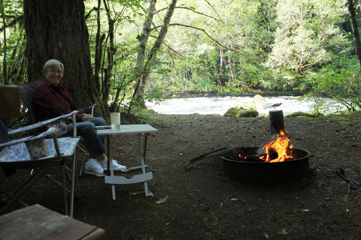
This is our site with a great view of the reservoir down to the right. Electric and water hookups, very nice modern bathrooms and showers, and a dump station for $14 per night for seniors.  Thank you, Idaho Power.

One neighbor indicated that he thought this was the best campground in Idaho.


There are even some colorful, blooming roses.


This is a view of our portion of the campground and the Brownlee.  Boats would launch and be out of sight and gone for most of the day.
Wow!  Was it tempting to stay at Woodhead for longer!!  But , we knew that we should get back into cell phone range after a few days.  Here in Idaho, you can watch the storms approach.

Back over the mountain to Cambridge, up Route 95 to Meadows, and then down Route 55 to Lake Cascade State Park on the west side of the lake.

Actually there are about 12 different campgrounds in the park on both the east and west side of the lake.
Some have electric, some full hookup and some dry camping.  We choose Buttercup for dry camping.


And a wonderful site right on the shore.  No hookups and we are alone in this little park.  All for the strange price of $11.51 for out of staters.  However, this reflects a 50% discount for seniors Monday through Thursday.

You will note we have the satellite TV working and we also have good cell here. Yea!!


When the clouds let up, we have a view of some of the Bitterroot Mountains.
We also get entertained by a family of Canadian Geese.

Thursday, May 14, 2015

McKenzie River, Paradise National Forest Campground, and John Day Fossil Beds

From the western side of the Cascade Mountains, we had traveled on Route 138 to Interstate 5.
After a nice visit to Timber Valley Escapee park in Sutherlin, Oregon, we head north towards Eugene, Oregon. We stayed one night at a pleasant Corps of Engineer park, Schwarz,in Cottage Grove. Then we headed east on Route 126.  This takes us back into the Cascades and now the Willamette National Forest.  This route follows the McKenzie River uphill.  What a nice campground!  Paradise is a good name with large , well separated sites.


This is our site, right on the white water river.

The moisture from the river has created a tropical feel in the campground with ferns, moss, and lots of greenery.


Such a nice campground for Jan on Mother's Day.  With some wonderful phone calls from family, a nice fire, and then a great steak dinner on the grill.  All this by the roaring(yes, roaring-----but in a nice way) river.


And then, surprise, a number of rafters, kayaks, and one row boat come rushing by.

This was a raft from a rafting company.
This link takes you to one of the companies that we saw launching in the park Oregon Rafting


There was a lot of screaming as the rafts went by.  This person was just finishing a wave to us.  The rowboat that went by was about 14 foot, fairly wide, metal, and with a flat bottom.  There were two people. One, in  the bow, was fishing( don't know how that worked out--we didn't think the fish had time to even see or smell the lure)and one in the back was rowing like crazy to keep the boat from crashing into the rocks.

The direct east route 242 is closed for the winter, so we leisurely do the loop of Route 126 north and east to Route 20. This takes us through the pretty town of Sisters and on to Redmond.
At Redmond, Jan and I decide to head north and see what the Cove Palisades State park is like.

The park is on Lake Billy Chinook.  You see the lake on the way in, but not from the campground.  Still, a very well maintained, beautiful campground.


The park surprises us.  The road there is through some very flat farmland.  It seems like you pass by a farmer's field and all of a sudden, you are heading down into this deep rock canyon surrounding a large body of water.

Eustis is keeping a keen eye on the turn for this very narrow bridge.


From the Palisades we travel north through the pleasant city of Madras and then south and east for a very scenic drive on Route 26. Along the way we detour into the Painted Hills Unit John Day Fossil Beds National Monument.  Such a long name!!  This home along the way shows the look of the high desert in this area.

Eustis is happy to see one of many horses in the area.  The next most popular animals  are beef cattle and sheep.  

Oh, and one pig farm.


Soon, we see the reason  for the name, Painted Hills


Jan and I learn that this area is famous around the world for fossils of plants and animals from the post dinosaur ages of 55 million years ago to about 5 million years ago.  They have collected thousands of fossils and are still collecting.

Millions of years ago, this was tropical.  With changes in the earth's crust and many eruptions of volcanos, this area preserved many fossils in layers.
These hills show the layers of the different millions of years.
At the visitors center is information on the house nearby that was built to be very, very,very green.
You see 24 solar panels on the roof. Also on the roof are two drain-down solar hot water panels.There is a heat recovery ventilation system( to preheat or cool incoming air with existing air),triple glazed, argon filled windows,extreme efficient appliances and lights, and mini split heat pump.  The house generated an average of 812 kilowatt hours and uses an average of only 298. There is a large, comfortable porch on the front.
The hills show layers of black, yellow,white, and red.

From the Painted Hills we head into Dayville.

Following the John Day River, we pass through Picture Gorge on our way to a very small campground.


In the center of this small town is the Fish House Inn and Rv Park.

Only seven sites.  But a picturesque, country club looking property.


We also had some brightly colored warblers? behind Lady Blue.


Sometimes, everyday barns look so nice along the main street.


The next day Jan and I head a few miles back to the Sheep Rock Unit of John Day.


A nice touch are the Journey Through Time Oregon Scenic Byway signs.  They are all along the fossil bed roads and also on the road to Baker City.


Near the entrance to this section is the large, modern Thomas Condon Paleontology Center Visitors Center.  A beautiful, modern building that fits into the surrounding landscape.  Also a green building.

The displays are well presented with clear information for those of us who are not well versed in fossils.


All kinds of examples of early hippos, horses, elephants, bugs, leaves, nuts, berries, and more.


For some of us, it is always nice to see pictures of what the bones belonged to millions of years ago.


While we were there, there was a group of about ten to twelve middle school children on a tour.  They were led through by a well spoken park guide and had good worksheets which they filled out with enthusiasm.


There were also some nice hikes through the area.

This was part of the Blue Basin.  Sometimes the colors are blue, sometimes more green.


Following the Fossil Beds, it is a short trip  to another nice state park, Clyde Holliday.  Again, it is well maintained, alongside the John Day River.

You could even stay in one of these teepees for the night.


From the state park, it is a beautiful drive over the mountains to Baker City.  We say "beautiful" a lot, but the views are spectacular.  Again, very few cars on the road and not many houses or farms along the way. The mountains in the background here are the Strawberry Mountains.  These are only a few of the many head of cattle along the way.  Our Baker City host indicated that the locals really enjoy their locally raised beef.


Could you live here?

Just be sure you have an economical , probably 4 wheel drive vehicle.

Everything is a long drive.


This is another view of the Strawberry Mountain range. This is from atop the hill going east out of Prairie City.  What a country!!!!