Translate

Sunday, May 26, 2019

San Luis State Wildlife Area and the Great Sand Dunes National Park,Ruby Mountain at Arkansas Headwaters in Salida, Colorado


We headed west from Lathrop State Park in Colorado on Route 160. Beautiful views on the way , going through two 9,400 foot passes and ---------
Blanca Peak--14,345 feet.  
A turn north on Route 150 and west on Route 6n brings us to San Luis Lakes State Wildlife Area.

As it turned out, the campground, with electric hookups , was free.
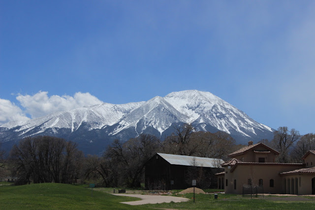
And the view above was of the Sangre de Cristo Mountains from our site.

Looking to the left in the distance is part of the Great Sand Dunes National Park. There were a number of RVs here. Probably because the National Park campground was full.

We will agree that the sand dunes seem totally out of place here at the foot of the mountains.

The dunes rise up to 755 feet above Medano Creek that flows by here.  People climbing the dunes are little dots(you can see a file of them heading up on the right side.) Kids were splashing in the creek and making sand castles.
These are the tallest sand dunes in North America, about 440,000 years old. The prevailing winds out of the southwest blow the sand from western mountains and then from the dunes themselves. Lesser winds from the northeast blow through the mountain passes and blow the sand back on the dunes. 

The water flow causes waves. You don't see these mountain views at the ocean beaches.  And yes----the water is cold!


From the dunes we head west on Route 6n to Route 17 north to Route 285 north to Salida, Colorado. Our destination is Ruby Mountain SRA Campground at the Arkansas Headwaters.  We called a number for the state office in Salida and had a wonderful talk with Mary, who helped us to choose Ruby Mountain(there was another campground-more difficult to get to) and to reserve a great site.  Wish all of the reservation operators were as helpful.

Inside the park, this gate leads to the Ruby Mountain Ranch, a private home.

What do you think?  Could you live here?
The property looked in good shape, but no one seemed to be here at this time.

We have spent a bit of time around Little Rock, Arkansas and enjoyed a number of different Corps of Engineer parks on the Arkansas River.  So this was great to be at the headwaters in Colorado.  If any readers have a question about too many National Monuments in the U.S., just staying here for a few days would illustrate for you how many people take advantage of the river  and the hiking,atv, and horse trails.  By the way the following is a link to a current (May 26, 2019) news bulletin about a record crest of the Arkansas River to come at Van Buren,Arkansas--near Fort Smith. We camped at Lake Fort Smith State Park on November 15, 2018. We met some very nice people in the park office and in the camp.

And a link to a few images from the recent flooding


WSA means Wilderness Study Area. There are 22,000 acres here and miles of trails.
A link to info on Browns Canyon WSA
Also, there are some dedicated outdoor groups in this area of Colorado. Check the links in the following 
There are also links for trails on the website.
A view from above the river(hidden behind the trees)
Lady Blue loves her campsite.
Everywhere you look are views.

We saw a number of rafters coming down the Arkansas.  The signs and maps indicate that you can raft for around 20 miles.
Hard to catch a picture, but there were a few who rode the river on standing paddle boards.

A lot of work went into the stones and gravel and leveling to create camping sites like this one. The steps go down to the tent site. You can see to the left of the middle tree the table for the same site. And all right on the river.
While we were there, a busload of school children--older elementary or younger middle school--came with a number of adults to spend a full day. They divided into 3 groups at tables and were totally into various lessons.  GREAT!!!

Worked a bit to get this picture upriver.


Above video is from Lady Blue's back window.
Jan and Bruce really enjoyed Ruby Mountain.

Our camp road. This corner is a single lane road.
Luckily no traffic when we entered and when we left.

A view downriver from the road.
Do you see Lady Blue??
Once again in Colorado, we can watch the clouds form as the moisture is forced up by winds against the mountains.
All kinds of rafters.
Just a picture from our back window.
Somebody's gotta do it!


Sometimes a group of rafters.

Views again as we leave Ruby Mountain and head into Salida.
Jan and I enjoyed our short visit to Salida. The people were very helpful and friendly. We were impressed by the homes, most of which were of different designs and looked very comfortable. The town itself reminds us of a North Conway, New Hampshire, in the sense that a lot of business is geared to outdoor adventure and the population we saw was fairly young. Unlike North Conway, it did not seem to have a touristy feel to it.
The following link is to images from Salida on their home page. 
You might like to click around for other galleries like the videos, or the dining guide.


Friday, May 10, 2019

Trinidad Lake State Park, Highway of Legends, Lathrop State Park; Colorado

Our first entry into Colorado. Coming down from the Raton Pass on Route 25.  We had just been in Sugarite Canyon State Park in New Mexico. The Raton Pass is 7,500 ft elevation. Lady Blue took it in stride.

Coming into Lake Trinidad.
A few of Colorado's famous peaks in the distance.

Trinidad Lake State Park is our first campground in Colorado.
Not making reservations, we soon learn the system. Colorado has a daily entrance fee--$8 per day.  This applies to everyone , camping or day visitor. Since we are here for almost 2 weeks, we purchase a one year pass for $80 and save a few dollars.  The other new idea is that Colorado went on a new camping reservation system in 2018.
Every site requires a reservation. But the plus of it is the Colorado Reservation System (https://cpw.state.co.us/buyapply/Pages/Reservations.aspx)
is on duty 7 days a week, 24 hours a day. Once we were used to the system we were able to find an open site and then either call or try online to make an instant reservation.


And Jan and I and Lady Blue are quite happy with our site overlooking Trinidad Lake.
We were able to have our mail sent to the post office in town. Also enjoyed walking the main street a bit. A good place for shopping as well.

After a short stay, we are on our way over the Highway of Legends, a loop from Trinidad through the mountains and over to Lathrop State Park. This is Route 12 and the picture above is of the coke ovens , a remainder of the coal industry. The ovens turned coal into coke , a purer product that burns with intense heat used to smelt iron.

The first of view after view of the snow covered mountains.
This range of mountains is part of the Rocky Mountains. Different sections have different names, and the Rockies contain the highest mountains in America. The following link is more specific  information from Britannica.com

A short video above , trying to give you a sense of the spectacular views along the way. Very little traffic today.

The road just meanders along .
Then ---your entire horizon is filled with snow covered mountains.

You wind up looking forward to coming around a corner or cresting hill , just to be greeted by a stupendous view.

Having been in Colorado now for a few weeks, we appreciate even more that we had this beautiful, sunny day for the clear views.
A lot of pictures, we know, but-------
This house seems to have its own grassy airfield( see the wind sock on the left).  Would you get tired of that view?

At this time, some of the peaks are snow covered from about 8,000 feet up to 14,000 feet and more.
This log cabin(sort of) is on a farm lot. You can see the stone foundation, pens , and fields, backed up by tall rock formations.

Part of the Dakota Sandstone Formation. Created millions of years ago, these are rock formations that were pushed vertical. As you drive by , it looks like a wall---the other side of this wall, you can look and see a view just like this one.

Getting close to the highpoint, this is Monument Lake. We went off the main road to look at a resort, built in the 1930's at this high lake.  Not open at this time, but a beautiful spot in the summer, we would guess.
Just beyond Monument Lake is Blue Lake-----for-----
you guessed it-- a particular amazing blue color. Pristine waters and great fishing.

We stop at Cuchara Pass to take a look around,
Also take a picture of Susie-Q(our GPS) who amazingly has stopped at exactly 10,000 feet.  We thought Lady Blue was happy to take a break.
The views change on the other side of the pass.  More snow on the sides and a threat for a few flurries ahead.

We note that there are many more cabins on this side.  Perhaps because of the views.
Jan managed a quick shot of this cabin with a 3 sided porch.
Nice place, right!
This formation is called the Devil's Stairsteps. These formations are called dikes and are formed from the volcanos.  They radiate out from the Spanish Peaks as far as 25 miles. They look like walls.

Coming down from the mountains and onto Route 160 east towards Walsenburg. Jan looks back to take pictures of the mountains.

Pictures are a bit misleading.
Note that there is a train moving along the valley.
Also a number of houses and ranch homes leading up to the mountains.

And suddenly we are Lathrop State Park


We are now familiar with the Colorado Reservation system and find ourselves this wonderful site.

Across from us we can see clearly the Spanish Peaks.
One of Jan's favorite camping spots.
Ok!!!
Bruce really likes it too!

There are two lakes in the park and they are known for fishing, swimming, and boating.  
In the Visitor's Center was this picture of a 38 3/8 inch , 17 pound Pike caught in April 25th this year.
Are you tired of these pictures yet???
This is from the 9 hole golf course at the park.
During the week, 18 holes will cost you $15.

There is a great hike up over the ridge.
We took this video from the trail.

A look towards the Spanish Peaks and the two lakes in the park

On top of the ridge was this super interesting one seed Juniper tree. A sign indicated that they had tested wood from this tree and it is between 200 and 400 years old.

A few floral pictures on the way.
The cacti are in bloom.

Many flowers along the path.
Since this is the high desert, many are about 4 inches tall with a few that are maybe double that height--saving water.
We loved that the buds come up pink and the daisy like flower is white.

A bit like a very short lily.
Again, short.
The sandstone has been here for many centuries. The weather wears cracks, creases, and holes.

More like a pea blossom.

Indian Paint Brush.
Different from new England.

And ending with our favorite picture from this part of our trip.
Reminds us of paintings from the 1800's.