
From Claytor Lake we head south on Route 81 and a
nice overnight stop at Hungry Mother State Park. We have stayed here before and it is always a pleasant stay with a nice hiking trail past the lake.
The next day we opt for a challenging Route 58
out of Abingdon, Virginia through the Appalachian Mountains to Big Stone Gap in the Jefferson National Forest. Great views, even on a murky day. In the middle of the picture above, you can see a person at the view point which is only accessible from the northern side of the divided highway. The smudges are from a dirty windshield! |
A reminder that you can click on the pictures and videos to enlarge.

Close to the center of town is the Jessie Lea RV Park. Alongside a small river with a walking path, it is a very pleasant ,friendly park.
|


If you note the 4 lane highway at the bottom, you have some idea of the rolling hills and mountains in the area.


Southwestern Virginia, in farm and mountain country, yet here and there houses like this one. Impressive.


Jan and I are still amazed at the roads in this section of Virginia and also into Kentucky. 4 lane divided highways with little to almost no traffic in places. Look above and weep New Englanders!

The bison were once plentiful here , even if less so than the plains areas.

Having come from the Shenandoah Blue Ridge Mountain area, through the western Virginia valley and then here to the Appalachian Mountains and the Gap, we can appreciate the views of the European settlers. They first stayed east of the Blue Ridge until land became scarce. A while longer to settle the valley beyond.
Then Daniel Boone blazed a trail through the gap in 1769. Then in 1775 Boone and others blazed a road through the gap opening the Kentucky wilderness and more to settlers.
One of the campground loops offers some great foliage color.

Senior Pass made it $10 per night.


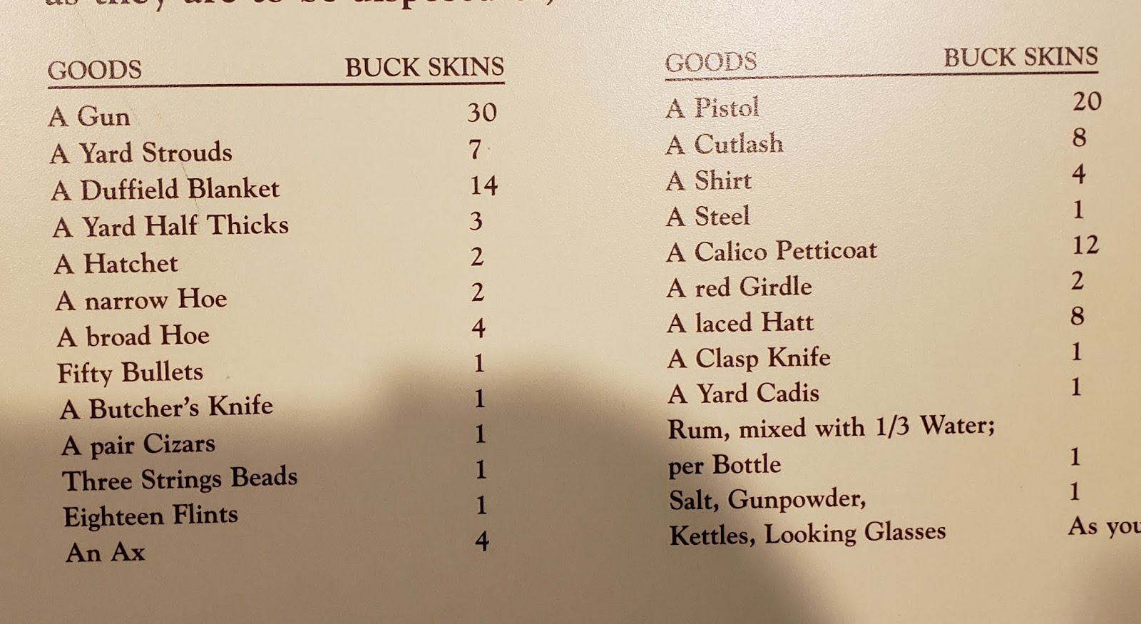
From 1716, this is a chart of the trading prices for European goods. We could understand the 30 buckskin price for a good rifle, but found the market for a calico petticoat at 12 buckskins a little surprising.

The Wilderness Road and Cumberland Gap are at the intersection of Southwest Virginia, Tennessee, and Kentucky. Even in many small towns there are buildings saved or recreated in the frontier log cabin style Images for typical Daniel Boone style log cabins . Also enjoy seeing the Kentucky style split rail fences.
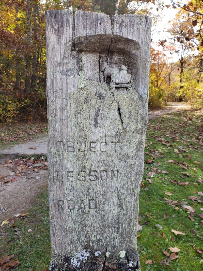
We did a hike from the Visitor's Center road up to the gap on the Wilderness Road Trail. No real views from there, but a nice hike and trail markers like this one for Object Lesson Road. Early engineers made a road on this section on the trail to demonstrate 1800's road construction that could last and avoid erosion.

Other markers like this one on the boulder seen below.


Easier to imagine some of what they were seeing and thinking at that time. As hard as it can be in a modern, busy city, you can even do this following the Freedom Trail in Boston .
Website for Boston Freedom Trail


These falls are the largest falls east of the Mississippi and south of Niagara Falls.
Once you click on the arrow button to play the video, most computers will allow you to click in the lower right square to enlarge the video to full screen.


Right next door is the Wolf Creek National Fish Hatchery. Inside are long , long concrete fish tanks filled with fingerling trout.

Outside are more concrete fish tanks covered above by netting--to foil predator birds from easy meals. These fish are much larger to almost fully grown when they are sucked into large trucks to bring to ponds and lakes and rivers in Kentucky and released. It seems that most fish here are Rainbow Trout.
No comments:
Post a Comment