Our last issue left us heading for Cheraw State Park in South Carolina. That was following US Route 1 south from Jordan Lake State Park in North Carolina.
Website for Cheraw State Park-South Carolina
On Lake Juniper, this park also features what it describes as an 18 hole championship golf course. We enjoyed a hike around the lake , including a nice section of boardwalk.
Website for Cheraw State Park-South Carolina
On Lake Juniper, this park also features what it describes as an 18 hole championship golf course. We enjoyed a hike around the lake , including a nice section of boardwalk.
Many people enjoying the park on the weekend.
Continuing south on US Route 1 towards Columbia. Then north a bit on Interstate 26 to catch Dreher Island State Park on Lake Murray.
Most of the sites have a water view or are on the water.
A perfect spot for a nice campfire. We rarely carry firewood with us and will not pick up firewood unless we know how the campsites are arranged. Many campsites now have newer fire rings that are so high you cannot easily see the fire. It is nice when you do see a great fireplace to have wood available in the campground.
A short video from our visit to Dreher..
Amazing to see so many great campsites unused this far south. But------it is cold down here too.
A spot for some major national fishing tournaments. Some 348 acres on Lake Murray with 12 miles of shoreline , very close to Columbia.
The map above shows how so much of the campground is on the water. A little confusing at first glance, but the two main camping areas are enlarged on the map and are shown in the gray areas of the main map top and bottom.
The map above shows how so much of the campground is on the water. A little confusing at first glance, but the two main camping areas are enlarged on the map and are shown in the gray areas of the main map top and bottom.
Staying still in South Carolina, we follow US Highway 378 west to Plum Branch and Hamilton Branch State Recreation Area. This campground is on the Georgia border where the Savannah River flows southeast to the Atlantic. This park is on a peninsula of the Strom Thurmond Lake. Where Lake Murray was 348 acres, Strom Thurmond is 70,000 acres!!
Still following US Highway 378 , then US Highway 78 to Athens, and then US Highway 29 to Fort Yargo--west of Athens.
We also made the mistake of driving into Athens, thinking it would be easy to find our bank there. Well, the bank was in downtown Athens and Lady Blue had a challenging time with some heavy traffic and narrow streets. But she did great. By the way , it dawned on us as we went through town that this was the home of the Georgia Bulldogs-top of the SEC east college football. As you can see above, Fort Yargo was a very quiet spot in Winder, Georgia
We also made the mistake of driving into Athens, thinking it would be easy to find our bank there. Well, the bank was in downtown Athens and Lady Blue had a challenging time with some heavy traffic and narrow streets. But she did great. By the way , it dawned on us as we went through town that this was the home of the Georgia Bulldogs-top of the SEC east college football. As you can see above, Fort Yargo was a very quiet spot in Winder, Georgia
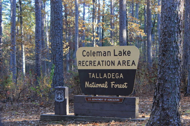
We made some short stops at two campgrounds after Fort Yargo. We were staying north of Atlanta to avoid heavy traffic. Even on State Route 20 to Interstate 75 south for McKinney Corps of Engineer Campground on Alatoona Lake, there was heavy traffic. This would have been a very enjoyable stop, except for a very noisy crew of tree trimmers . From McKinney we headed south on State Route 92 to US Highway 278 west, US Highway 27 south, and then US Highway 78 west into Alabama. Coleman Lake is a wonderful National Forest Campground. Normally a very easy place to find, this year it included a five mile detour over a very dusty dirt road. Still a favorite campground though.
Thought we would take this opportunity to illustrate a website we use to look up information on National Forest Campground. This information was compiled by Fred and Suzi Dow. Basically they traveled all across the United States-first in their Class C Motorhome and then in a larger unit. If you look below on a portion of the Coleman Lake Info, you will see a great deal of good information for RVers.
Thought we would take this opportunity to illustrate a website we use to look up information on National Forest Campground. This information was compiled by Fred and Suzi Dow. Basically they traveled all across the United States-first in their Class C Motorhome and then in a larger unit. If you look below on a portion of the Coleman Lake Info, you will see a great deal of good information for RVers.
A big Thank You to Fred and Suzi Dow. This is an enormous task well done!
Our next stop was a bit more challenging. We followed Interstate 20 into Birmingham , Alabama. A simple connection to Interstate 65 north became a detour through the street of downtown Birmingham---interesting and nerve wracking---signs could have been clearer. But we found our way to Rickwood Caverns State Park.
Unique experience to go into a cavern that has the usual formations of most caverns plus Christmas decorations.
A few more examples. Many families were enjoying the hour long walk. Guides along the way were dressed in holiday costumes.
Many colors
Also sections where the level rock was used to create winter villages.
Still, as here, you can see the cavern formations like these curtains.
The volunteers put a great deal of effort into placement and lighting. You could see that the volunteers in the cavern--many of them high school age--were enjoying the experience.
Happy to avoid Birmingham, we head west on US Highway 78 into Mississippi.
Close to the Natchez Trace Parkway, we stop this time at Tombigbee State Park. We met some very nice park workers here.
At Tombigbee, a set of playground characters we had not seen before. Native American on the left and cowboy on the right. The six shooters on the right are part of the ladder.
Following US Highway 278 west, we found we could stop at Oxford for some groceries. Well----our first stop-a Kroger grocery store =was under construction for additions and had very limited parking, So, we headed further west on the local road. Rather than coming to the next store we wound up at an entrance booth----to the University of Mississippi( Ole Miss). We told the guard that we were obviously in the wrong place, but he invited us to drive a tour through and then how to find our way. What a beautiful campus! Well planned and yet separate from the town itself. We were impressed that the marching band had its very own separate building! By the way, it was an easy, quiet tour because students and faculty were away on Thanksgiving break.
Above is a video from Ole Miss Halftime 2019 "A Day at the Circus" If you let it play after the halftime you should see a video of Drum Major tryouts----Interesting!
US Highway 278 and Interstate 55 south brings us to Wallace Creek Corps of Engineer Campground on Enid Lake.
US Highway 278 and Interstate 55 south brings us to Wallace Creek Corps of Engineer Campground on Enid Lake.
Another site with lake views and a nice combination of walking loops. Many of these lakes have been drawn down 6 to 12 feet or so for maintenance of the shoreline. We were assured there was no drought happening here.
Spots to stop on your walk or just have coffee and watch the birds and fishermen.
Back up Interstate 55 to Batesville to pick up our mail and then west and south on US Highway 278 . This follows the Mississippi River south through cotton fields and more. Connecting on US Highway 82 , this is a quiet highway crossing the Mississippi.
Hard to get good pictures from bridges, but this will give you an idea of how high the Mississippi River was.
Destination this time is Lake Chicot State Park in Arkansas. This park is very close to the Mississippi River and at one time was part of the river itself. The river changed its course and left this lake. Engineers created a fresh water flow to keep the lake alive and now it is a popular recreation area.
Sunsets are wonderful here.


