Translate

Wednesday, July 10, 2013

Wading across the Mississippi

You never know what might suddenly appear on the side of the road.  This was a sculpture garden(large) beside Route I-90 as we left Vermillion State Recreation Area.  It is facing across the highway to westbound traffic.  It certainly attracts attention.

Speaking of Route I-90( Yes, that is the same Mass. Pike that winds up in downtown Boston), it was an interesting drive from western South Dakota to Minnesota. 

Coming east out of the Black Hills, the land reminds you a little of Utah, but not totally desert.  It is not long before the fields start turning quite green with fields of beef cattle  as far as you can see.  Some herds by the highway are hundreds and into the thousands with plenty of good grazing land.

Then the grass becomes much higher and the fields become mostly corn fields.  There are many shiny silos at each farm.  Jan counted more than 20 silos at one farm.   Driving through some towns we see the cooperative grain elevators.  One town had a large tank labelled Ethanol.  The gas stations have a separate pump for extra percentage of ethanol( only for flex fuel cars).

Also noted on I-90.  Very little traffic.  And after a number of miles, we both realized that we were not seeing any trailer truck traffic.  No Trailer Trucks!!  Not sure why.  Must just not be a preferred route.

Entering Minnesota and heading north towards Itasca State Park we note that the farms are becoming smaller and the hills rolling and closer together.  By the time we reach the park, the landscape looks much like northern Maine.


Always happy to stay at state parks.  We do note, however, that Minnesota and others seem to charge a camping fee in the $20 range and then add on a day use fee of $3 to $6 dollars.  Out of staters do not get discounts.

We usually opt for dry camping sites. They are quieter and most often larger than the electric sites.


Above and to the right are pictures from Camden State Park in Minnesota.   Some nice trails were found and good sized campsites.


Another example from the Civilian Conservation Corps. President Roosevelt in the 1930's created the Corps to put men to work who had lost jobs to the Depression.  We have seen many strong, sturdy state park buildings and walls all across the U.S. still being used today.  Not only long lasting , but very pleasing to the eye and fitting to the outdoor feel of the parks.


Another nice site, this time in Sibley State Park.

Without hookups, we are in a very quiet section.  The electric sites here were very close together.


Hard to get road pictures while moving.  On this road there was no break down lane or turnout, so moving pictures it was.

This was a typical farm from the west central part of Minnesota.   Towns were quite far apart.


So glad we headed for Itasca State Park!

Having seen the Mississippi River in New Orleans and camped beside it in West Memphis, Arkansas; we decided it was a good idea to see where the river gets its start.

Once again, we opt for a dry camping site.  Very woodsy with lots of privacy.


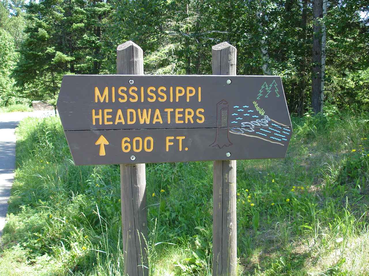
And sure enough, there is a trail to take us to the Mississippi Headwaters.


Seems it took a while in the 1800's to determine where the river actually began.


2,552 miles of river.  It's hard to imagine that this 3rd longest river in the world could find its way from northern Minnesota to the Gulf of Mexico.

It manages to drop an average of 3 feet every 60 miles.


Actually, if you enlarge the picture to the left, you will see that it drops much of its elevation before it leaves Minnesota.


And there they are!!!

Jan and Bruce are wading across the great Mississippi River.

On a hot humid day, it was actually quite refreshng.


Some of you might remember this picture from the Spring of 2010.  We were camping in one of our favorite campgrounds, Tom Sawyer, in West Memphis , Arkansas.  The picture is out the back window of our 5th wheel trailer.  We remember this stay, because we had to leave the next day .  The water was rising and the river would flood.  Within a week, our campsite would be under 10 feet of water.  A common occurrence at the campground, but unusual for us.


This was posted at the park office.

In case some of the campers were reluctant to leave, the 31 foot level was quite firm.  The campground closes!


Itasca had something for everyone.  Beautiful , large swimming beach.  Rental canoes and boats.  And even bicycles. 


Lots of trails.

Also, lots of deer flies and mosquitoes.


Itasca is the oldest state park in Minnesota.  It was another good decision by forward thinking officials to save and preserve the natural spaces and woodlands for future generations. 

Without their preservation, the park would have fallen to the lumber interests in the 1800's, and then to private owners.


Jan is standing in front of the oldest white pine tree in Minnesota, about 300 years old.
Sometimes, this area is referred to as the land of the tall pines.

They are!


We always like seeing the lodges at the parks.

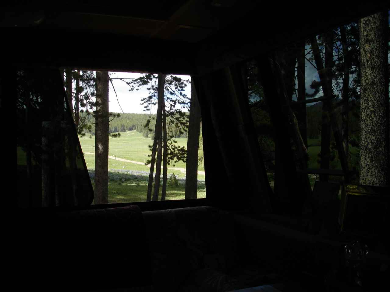
This living room space at Douglas Lodge is looking so comfortable.


We did have a late lunch at Douglas Lodge.  Two glasses of Minnesota red wine, some appetizers of fried Walleye and Sweet Potato fries, and a slice of Blueberry Pie A La Mode.

Besides the Walleyes, Minnesota is also known for blueberries.


It is also know for its state flower, the Ladyslipper.


Looks quite different from those we have in Massachusetts.

Minnesota is also the land of 10,000 lakes.
We believe it.  On the way to Lake Itasca, we saw lakes on both sides of the highway for miles and miles. There are so many campgrounds and resorts, we had a hard time imagining that they could all be full at any time.


In Douglas Lodge was a poster commemorating the 1991 Centennial Wagon Train.  16 days, 279 miles,40 wagons, and 200 saddle horses; the wagon train traveled from the state capitol to the Mississippi headwaters in Itasca State Park.

We liked the saying next to the picture of one of the participants.

You might not need a horse, though.   Take your RV or camping equipment and visit the national parks, state parks, and national forests across the United States.


We stayed an extra day at Itasca while the rains moved through.

The plan was to head to Wisconsin, but how could we not stop at a National Forest campground on a lake.

We are doing our best to be sure we arrive on Cape Cod for family camping August 10th. 


Not an easy task when we have these $7 per night spots right on a beautiful Minnesota lake!


Saturday, July 6, 2013

Mt. Rushmore and a bit of South Dakota


Out of Wyoming and into South Dakota.  We decided to stay in Sturgis--coming up on the July 4th holiday. There are a number of good campgrounds in Sturgis and in the Mt. Rushmore area. We stayed at Rush No More.  Very nice with a good laundry----and a beer garden(It's Sturgis--the motorcycle capitol.)
Our preference on a quieter day would be the Black Hills National Forest.  We took a look at Sheridan South and would definitely try that another time.

After a stop for groceries in Rapid City and finally having a good experience for an oil change at Rapid Lube, we headed for Mt .Rushmore.


After hearing so much in our lifetimes about Mt. Rushmore, we were ready to be underwhelmed.

But quite the opposite.  We really enjoyed our visit.
The shear enormity of carving sculpture out of a mountain hits you when you see the real life size of the mountain.

To see the mountain before and then after is amazing.  The visitors center helps to detail some of the process over the years from 1927 to 1941.


Very interesting photos and equipment for the dynamiting(precision), the smoothing after drilling, the air compressors, and the lifts for equipment were on view.

Just seeing the pictures of the wooden walkway the workers had to climb each day to the top and then down and the end of the day--exhausting!

Add to that the pictures of work in the extreme cold of winter.


The closer we got on the trail, the more appreciation for the scale and the precision of Gutzon Borglum, the sculptor.


From below, you get a sense of how much rock was blasted or drilled.

Much rock had to be blasted away just to get to solid granite that could be sculpted.

Add to that appreciation for Borglum's creativity and flexibility when Jefferson did not fit to the left of Washington due to weakness in the granite.  No way to tell that from the final result.


Borglum died before the completion of the entire sculpture, though he did see most of it.  He originally was working on models like this, head to waist.  But after his death, his son , who had been working on the project, completed the sculptures as head shots.


Many interesting displays at Rushmore.  This picture, may be a little hard to see with glass reflection, was the first noted color picture of the Black Hills.  It is of Gen Custer's 7th Cavalry.  If you enlarge the picture you can see that small line of the 100 wagons moving through the Castle Creek Valley in 1874.

The disastrous Little Bighorn was in 1876.


There are some interesting billboards in South Dakota.

This creative? name for a wine does get your attention.


Coming through eastern South Dakota, we are struck by the large, very green expanse of corn fields.  As far as the eye can see.  Sometimes that is all you see--no houses, ranches, people.

Maybe because we were used to the desert look of Arizona, New Mexico, and Utah, we really enjoyed all the green fields of South Dakota.

And the corn in many fields was higher than "knee high" on the 4th of July.

The picture above is of the famous Corn Palace in Mitchell , South Dakota.  I had read about this building in RV magazines and had forgotten about it.  But when we saw a billboard for it we couldn't resist.
The palace goes back to 1892 when the city of Mitchell was only 12 years old.  The idea was to get visitors and farmers to understand that Mitchell had a healthy agricultural climate. The above picture looks normal from a distance, but if you look closely you can see that the murals and decorations are all made from corn or grasses.


This is a little closer view of another mural on the side wall.  You can see varied colors of corn cobs used to create the picture.

The murals change each year.  A big celebration is held in the late summer and thousands come to Mitchell to celebrate  ---with some big name performers as attractions as well.


Some parts of the murals are created with fibers from the corn or grasses.


The murals are created as corn by the numbers.  Just like painting by the numbers.


You can see some of the textures here.


 The subjects vary widely from year to year.  Inside there are many exhibits about , you guessed it---corn.

We found it very interesting.  Never knew so many products were made from corn.


Some products we were aware of.


The still was just one of many displays.


Last night , July 3rd, we chanced upon a last site on the Missouri river.  The manager was so nice and took us out in her golf cart to find us a parking spot next to the public park that overlooked the Missouri.

It was dry camping, but a beautiful view with some fireworks to boot.

Today, the 4th, we chance again to the Vermillion State Recreation Area.  WE chance upon the very last site--to the left.  One night only, but quite nice!

Monday, July 1, 2013

Cody, Wyoming and Sitting Bull NF

There are a lot of interesting things to do and see in Cody, Wyoming.  This is the town that Buffalo Bill Cody created in 1901.  A symbol of the West, he was also a great showman.. When he passed through this area in the 1870's he was impressed by the possibilities and the proximity to Yellowstone.

After an attempt at farming , Cody realized that managing water in this section of Wyoming would require more money and effort than he could manage.  He encouraged the federal government to become involved and eventually the government decided to build this dam.  When finished in 1910 it was the tallest dam in the world.


Later, in the 1970's the dam was raised creating a much larger volume of water for the irrigation efforts downstream.  This area only receives a few inches of rain water a year.  But there is a huge runoff of snow melt each spring and summer. Controlling that runoff enables 93,000 acres of beans,alfalfa,oats,barley, and sugar beets.


It didn't take long for the largest dam title to be shifted elsewhere. Think Hoover Dam among others..

Still very impressive. This tall wall of rock is also the entrance for the first of three tunnnels leading into Cody.


Looking over the dam, you see there is plenty of water heading down to the irrigation pipes. 

And also towards the hydro power plant about a mile downstream.


We did not spend a lot of time in Cody, but we could have.  The town seemed well planned and very inviting.  We did find the local walking paths and took advantage. 

At another time, we might want to visit what is considered an excellent museum in town, The Buffalo Bill Museum, as well as an ongoing night rodeo.  We did take advantage of an excellent store called Cody Meat.  They had excellent cuts of local Black Angus as well as other meats.  Our tiny charcoal grill was quite happy!!


We followed a southern route out of Cody, following Route 16 into the Bighorn National Forest.  So many choices of campgrounds along this mountain route and we chose Sitting Bull.

It sits at 8600 feet altitude across from a good sized mountain lake.

This southern route still climbed well over 9,000 feet. But we were warned not to try Route 14A in the north which was supposedly extremely steep with many hairpin turns.


As soon as you turn in for the 1 mile road to the campground, you see the northern snow covered Big Horns.  A fast moving mountain stream flows by the campground down to the lake.


We walked down to the lake later.  There were a few fishermen and some youngsters enjoying the fresh water.

There was a mother moose and her young calf that would feed here most mornings and evenings.


Kind of matches Lady Blue?

There were many field of these Lupines?.


Nestled in the pines, we did not have cell phone, internet, or TV signals.


Now, what can we do?


Absolutely!  Perfect spot for a campfire. 

By the way,  for $8.00 per night, this was a very large site.  When we arrived, it had been raked and groomed by the very friendly and attentive hosts.


The view from inside Lady Blue is of an ATV road as well as the stream.  An occasional deer would browse the meadow.


Out the back window, lots of pines.


We spent a lot of time by our fire, enjoying the view and the peace and quiet.

This road through the mountains had a number of parking spots for snowmobiles and lots of snow fences for the winter.  Many signs of elk and deer along the way.


Sitting Bull National Forest is definitely added to our favorites list.


Once down out of the mountains, we take a chance on a state park at a large lake.

Keyhole State Park is located in Moorcraft, Wyoming beside Keyhole Reservoir.


Along the field, we found a large crop of bright pink thistles.


There were a number of  divisions within the state park.  Also included was a 6.2 mile walking or biking trail.  Since we are without bikes for the time being, we hiked for a few hours.


From one of the campsites, you can look across this small section of the lake and see---

Yes, That's Lady Blue on the top of the opposite ridge.


So different from Sitting Bull, but so nice in its own right.

The fields , campsites, and gravel roads reminded us of a number of spots in northern Maine.


We enjoyed watching the weekend family campers enjoying the beach, swimming, boating, and fishing


We were surprised at the number of very large and very nice boats around the lake.  Even more surprised that they all were kept to a very low speed and wake.  Some very serious fishermen were about,  The campground host reported a catch of about 22 fish for one afternoon.


Lady Blue approved of this campground as well--though quite different from Sitting Bull.

Most sites here were dry camping(no hookups), but there some electric and water sites in different areas.


On our way out of the park, we are reminded that this area has many sections of road that are designated " open range".

Somehow, this particular section had barbed wire fences on both sides of the road, so the cattle had nowhere to go except on the road. 

Eventually some park rangers headed them back to their pasture.  We were reminded of those wonderful steaks from Cody!!!


In no time at all, we are entering South Dakota.  A rural town called Sturgis.

I'm sure some of you might remind me that this place is quite busy in August.

Some of you might even say that it becomes the motorcycle capitol of the world for a short time.

Right now, it's very quiet.