From Lake Guntersville State Park in Alabama, Jan and I head east on Route 227 to Route 75 north and then to Interstate 59 in Tennessee. We then follow 59 to Route 24 through Chattanooga to Interstate 75 north. Harrison Bay State Park was just north of Chattanooga. We stayed one night, but not our favorite . Sites were too close together. Also not many were level. The next day we follow Interstate 75 north through Knoxville and then onto Route 11E which brought us to Panther Creek State Park in Morristown.
This was a very enjoyable state park with good separation and some interesting hiking trails. We did stay here in the Fall
Trying to keep to a reasonable schedule to make appointments in Maine for late April. So we head again the next day into Virginia, following 11E out of Morristown north to join Interstate 81.A turn onto Route 16 in Marion, Virginia takes us to Hungry Mother State Park.
A beautiful state park set around a lake plus miles of hiking .
Since the roads are narrow, we stayed at Camp Burson which was convenient, very well laid out , but perhaps a little more crowded if full. This campground avoids the very narrow roads--not recommended for larger RVs.
Right on the lake is the park restaurant. Not open yet, but you can see a nice patio plus lots of seating.
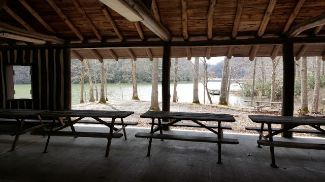
The inside of a shelter built in the 1930's by the Civilian Conservation Corps.
The shelter , big enough for a big family picnic or more, also has a great view of the lake.
Much of this state park was created(including the lake) in the early 1930's by the CCC. The CCC was created during the Great Depression and recruited young single men from 18 to 25 who were unemployed. They were paid $30 per month , of which $25 was sent back home. The remaining $5 paid for their extras and entertainment. Also included was room and board. Many of the young workers were quite enthused about the great meals--food was in short supply where they had come from and most were undernourished.
Jan and I are always impressed by the great number of buildings, state parks, national parks, national forests, and other projects built by the CCC. Great undertakings in the 1930's that still remain today. From Yellowstone in the west to Acadia in east and much more. And to realize these projects--also including the giant dams of the west--also helped to revitalize the economy!
This is a copy of a picture at Hungry Mother.
Jan loves this cabin with a fireplace and porch.
Back on Interstate 81 north. A road sign mentions The Dutch Pantry above for exit 60. We say "Why not"
Good decision. Not only great pastry and bread, but Jan and I picked up a wonderful Ruben sandwich and a Roast Beef sandwich.
There are a number of wonderful Amish or Dutch pantries, stores, and restaurants in Virginia and Pennsylvania. We know there was another in Stuarts Draft out of Staunton, Virginia
A quick stop for a night at one of our favorites, Claytor Lake State Park in Dublin , Virginia.
Some nice pics from May, 2016
Back to Interstate 81 and north to Natural Bridge exit and Cave Mountain Lake campground in the Jefferson National Forest.
What a great new park for us!.
The sites are well separated and most of them were quite level and large. The hosts were constantly maintaining the sites to keep them clear of leaves and branches. Our price with Senior Pass was $7.50 per night. No hookups and no threaded water spigots, so plan ahead. Lady Blue was prepared . Good workout for the solar panels and generator.
Again, a park built by the CCC in the 1930's.
Love the framing of the open window in the shelter.
Unusual fireplace with a mantle of layer rock( looks like limestone but???)
Added room could be for a worker or just for food prep--kitchen.
We had to work to get around the lake , but a path got us around one side easily.
This was a new one for us.
Trout stocked lake, but reserved for youth 15 and younger in the early season. A number of fishing platforms all around the lake.
The building was probably a water pumping station.
We were taken by the green lichen on the rock.
Lichen only on the rock , not the cement.
What an inviting beach for the summer!
Back onto Interstate 81 heading north.
South of Staunton, we exit onto Route 340.
Route 81 offers some great mountain views.
Route 340 is a very scenic road that parallels Interstate 81on the west and the Skyline Drive on the east. Along the way are great mountain views, ranches, farms, and rivers.
The Blue Ridge Mountains are quite a sight , even in the haze.
Keeps reminding me of the those art works in Junior High that we used to make from ripped colored construction paper.
These are not as big as the giant western farms, but still good sized.
They are probably much happier to have much more rainfall too.
Every now and then some impressive mansions.
Some look to be more than a century old.
The Lady Blue group is following Route 340 north to Elkton where we enter the Shenandoah National Park. By the way, following Route 340 through Waynesboro is tricky.
Still good views of the valley, even on a warmer spring day.
We have other pictures from the Skyline Drive in the Fall of 2017.
Some riders exercising their horses on the trails at the entrance to Big Meadows on the Skyline Drive
Big Meadows is a great campground for a number of reasons for us.
It is open in April. There are many sites that are held for first come, first serve customers. The camping is dry only-no water, electric, or sewer. Good supply of firewood. With Senior Pass the fee is $10 per night. These sites above are some of the walk-in tent sites. Again--good separation.
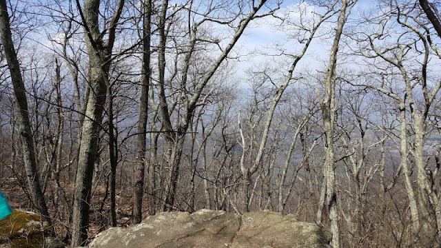
This is a view from the Lewis Falls Trail , right off the campground. The elevation here is about 3500 feet.
Once we got our breath back , smiles for the camera.
The above is a trailer or tent site. Can you imagine?
This time of year you could probably have it during the week. But these view sites can be reserved and they will be taken for the weekends.
You could have your site here and head right out below on the Appalachian Trail(white marker on tree.)
Many campers for the weekend were hiking up to 20 miles or more from here.
This unit was our neighbor.
It is a Sylvan Sport.
Another unusual unit was the cricket.
We saw two of these in the campground. When you see them first, they seem to be broken in the middle.
Our first day was in the 70's.
But the next day quickly dropped with rain and colder temps.
That night we were encouraged to leave Lady Blue for the brick and concrete bathrooms due to a tornado watch. Did not come too near. The rain was heavy and the next day was forecast to drop to about 22 degrees. So we move on.
We headed off the Skyline towards Luray. We followed our GPS to Route 340 over this back road--sharp curves and very narrow.
Some wonderful views though.
Still some larger farms off Route 340.
Some even getting the fields ready for planting.
And over the hill with a view of a small village.
Once on Interstate 81 again, we make this one of our longer travel days. Over to Winchester , Virginia and then north through West Virginia and Maryland into Pennsylvania.
Pine Grove Furnace State park is in Gardners.
A reminder for RVers. We always try to check for directions online or in our campground books for directions. If we were to follow our GPS, we are sometimes taken on dirt roads that do not really lead into the parks. In this case we go a little north on 81 to follow 233 back to the campground on a shorter road.
The sites at the campground seems to have been redone since our last visit in 2010. Many great sites with new level gravel and electric boxes.
We noted this sign at a cabin on our hike through the park.
Gee? who would want a Fuller sign?????
Heading north , still on Interstate 81, the weather turns colder and-
WHAT!!!
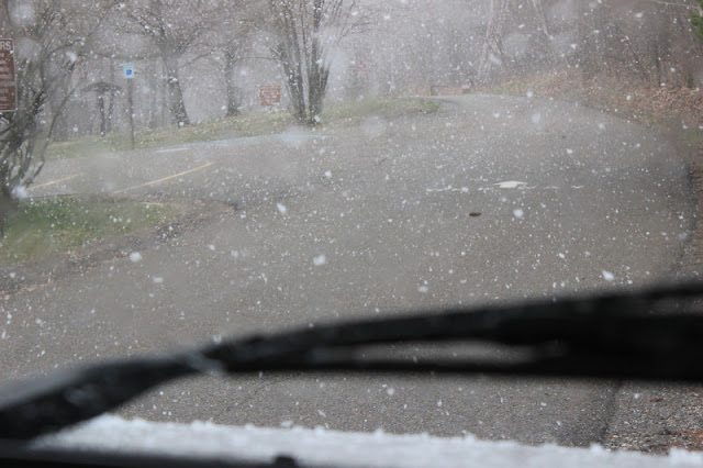
Why are we driving in snow???
Luckily, the snow does not catch.
The next exit is for Locust Lake State Park in Barnesville.
Yep! Right place
Good thing, because the snow gets heavier.
Yes Bruce!
You decided to be here in April.
Lady Blue is okay with it though.
Good thing, because the camping here will be cold.
We do have electricity though.
Beyond the trees we can see the lake. A great little hiking path around the lake .So we sit back and enjoy the snowy view.


