Translate

Friday, November 7, 2014

Heading West


Twin Lakes Corps of Engineer is on Hartwell Lake,  a large lake of 56,000 acres that borders South Carolina and Georgia.  The nice thing about this campground is that 89 of the 102 sites are waterfront sites.

Early morning offers a water view with steam rising.


Getting away from the busy roads of the east, we find it enjoyable to look for "red" roads.  These are roads on our AAA maps that are marked in red and are called principal roads.  We will also use dark black roads that are through roads on the AAA maps.  In this case we followed a black road to Petersburg COE in Petersburg, Georgia.  A very quiet road with small towns along the way.  Petersburg is on J. Strom Thurmond Lake, a 70,000 acre lake with 1,000 miles of shoreline.  When you look at a map you might think that Hartwell Lake and Strom Thurmond are the same. But Hartwell is north and Thurmond is the larger body of water to the south. This large lake means that many campers also bring boats for water sports or fishing.  Right now, it is mostly fishing. The campground information indicates good fishing for largemouth bass, bream,crappie,catfish, and striped bass( yes, that is fresh water striped bass for you New Englanders.)
Again, most campsites have water views like ours.  Also, most have water and electric and are pullthrough sites.  Jan and I had camped in another COE park near here in 2009 called Winfield COE.  Again, huge sites, but now closed in the fall.  Petersburg is the only COE campground open on Strom Thurmond this time of year.  Another nice campground in the area is Mistletoe State Park.    In 2009 we almost missed out on a site because we missed the Augusta Masters Golf Tournament by only a few days. Augusta is about 25 miles south. The following link is an entertaining one for golfers. Augusta golf . the link opens differently each time with a new short video and then goes to the golf page.

If you do visit these lakes after September, realize that most of them lower the water levels for the winter. This is needed to allow work on docks and other shore facilities.  There are still wonderful water views around the parks.


Heading west, the obvious route is the Interstate 20 towards Atlanta.  As we head west, it is sometimes curious to note that there are not always direct roads to places you want to go.  However, in this case, around northern Georgia, it seems all roads lead to Atlanta. Really!!!   If you look at a map, you can see at least 9 major highways leading into the hub called Atlanta.  If you ever have the occasion to drive around Atlanta , you will know that gridlock can happen at any time.
So!!  This time we head south from route 20 on route 44 to route 16 and-------you guessed it-- avoid Atlanta all together.  This quiet road takes us to Jackson, Georgia and the Indian Springs State Park.
These sites are very level and large.  Very few people in the park, but they have a list of activities through the winter and seem to be active on the weekends.  An old Creek Indian spot enjoyed for the healing waters, it was a resort area in the 1800's.  Thought to be the oldest state park in the nation.  More information at this link.Indian Springs Info.


After Indian Springs, Jan and I continue southwest to the Georgia border and West Point Lake COE in West Point, Georgia.  This lake cover 35 miles along the Chattahoochee River along the Alabama, Georgia line.  Like other large lakes in the area, the irregular shoreline measures over 525 miles, providing many opportunities for fishermen.
 A large number of campsites again and most have water views like this one.  Notice how Lady Blue has room for a number of friends.  By the way, the site is not concrete, but a hard pack white gravel.  Extremely level.  More info at this link West Point Lake.

Into Alabama, we follow route 50 to 280 and over to Wind Creek State Park. In Alexander City, south of Talladega and southeast of Birmingham on Lake Martin.

This is a huge lake and a giant campground with 626 sites and many of them with a waterfront view.  We will note that, although it is chilly today, we are much warmer than what we see for temperatures up north.


 We almost missed it!!!  Jan and I were enjoying the site, when Jan saw an orange glow out the window. She ran to the calendar and sure enough, it was the full moon.  How nice of them to give us this perfect spot!


Saturday, November 1, 2014

Along the Blue Ridge Parkway

Heading west through southern Virginia, the weather forecast indicated that this would be a perfect time to jump up on the Blue Ridge Parkway.  Before doing so, Jan and I make a stop at Salthouse Branch COE campground on Philpott Lake in Henry Virginia.

A very nice campground with some very helpful hosts.


With a calm wind, the reflections show some nice colors in the lakeshore.

Getting to this campground, we were on Route 220 , coming through Martinsville on a Sunday. Signs said "watch for traffic backup on race day", but no backup. So we thought, "Ha", no problem.  Off we go on the exit to get gas.   Right into a traffic backup, right into the gas station which was at the racetrack. All kinds of people in the street, crossing the highway.  Well!!!!!!
Turns out, the race was just beginning at the Martinsville Speedway Nascar Sprint race.  And some guy named Dale Earnhardt Jr. finally won the grandfather clock winner's trophy that he had wanted since childhood.  Follow this link to the story. Dale Earnhardt story.


The Blue Ridge Parkway runs for 469 miles along the crest of the southern Appalachians and links two eastern national parks, Shenandoah and Great Smoky Mountains. Jan and I jump on in Meadows of Dan, Virginia at milemarker 176.  The speed limit is 45mph which is plenty for car or small rv.  The above view is typical with the elevation going from 649 to 6,047 feet.  Our trip was mostly from 2,000 feet to 5,000 feet.


Along the road are also a number of tunnels, most of them in North Carolina in the higher elevations.


The park is popular almost all year round, except for the winter.  Parts of the park road are closed in winter weather with no road services.  The spring season is very popular with a great number of rhododendron and other flowering shrubs. But the fall foliage season is probably the most popular.  We are here just after the peak color, but there is still plenty of color at the lower elevations.


All along the route are many turnouts for the wonderful vista views.  Also , are many historic stops and historic homes or buildings.  This is the cabin of "Aunt" Orelena Hawks Puckett.  She lived to 102 years old and was a midwife, delivering more than 1,000 babies.  The last delivery was in 1939, the year she died.


As the elevation increases, the color dims.  But the views are still spectacular!

Jan and I spent two days on the Blue Ridge, for more than 230 miles.

On weekdays after peak color, we enjoyed a very peaceful drive.  Little traffic and plenty of parking at most of the scenic overlooks.

Where do those stairs go, Jan?


Interesting, some of the history near here.

Some of us remember the song as sung by the Kingston Trio and that the song was the number one song in 1958. But we could never relate to you that it was based on a true story of the murder of Laura Foster in 1866 in North Carolina. Remember, you can click on pictures to enlarge.

This link will take you to that Kingston Trio hit
"Tom Dooley" by The Kingston Trio


There are national park campgrounds on the parkway and also some private campground just off the parkway.  The national park campgrounds are dry camping( no hookups). We found that most sites just fit Lady Blue at 24 feet.  But, there were some larger trailers and motorhomes in the parks-only a very few.

The charge for camping-senior pass--$8 per night.
This was Julian Price Campground.


The camping was comfortable.  You might want to know that most of the sites were not quite level.

Also, you might want to know ahead that there was no phone or internet signal at the campgrounds we stopped at.

Doesn't Lady Blue look "at home"?


Our second day will take us to Mount Pisgah at 5,000 feet. Most of the day will be at 4 to 5 thousand feet with many sharp curves and steep hills---often at the same time.

But----those views!!!


The Blue Ridge Parkway was first conceived in the 1800's , but the first construction began in 1933.

Jan is walking under the Linn Cove Viaduct which was part of the final construction in 1987. This bridge snakes around Grandfather Mountain without damaging the mountain itself.


I'm including this stock picture of the viaduct.  We could not stop for a picture, but here, you can understand why the bridge is something of an engineering marvel.

This link will give you a little more information.
Wikipedia article on Linn Cove Viaduct


Also, along the route is a popular stop with a little hike to the Linville Falls.


Lady Blue is having such fun!

But , she also needs these stops for a little rest now and then.  These roads are steep!


Also along the way is the Blue Ridge Music Center.  We had stopped there back in 2009.  That would have been on the first day and we were tempted, but not this trip.  They feature music history of the region and usually live music every day.

Our end destination this trip is Pisgah Mountain and the Mt. Pisgah campground.  Right across the street is the Mt. Pisgah Inn and this wonderful view. Yes, the scenery in the background looks great too!!!
Mt. Pisgah was part of the Biltmore estate and the city of Asheville and the Biltmore Estate  is only about 25 miles or so back north off the parkway.  We had visited there in 2009 as well.  We were tempted to stick around for the beginning of the Christmas season at the estate in about a week.
We were so lucky to have a good day for this view at the Mt. Pisgah Inn.  Even at the end of the season, the Inn was quite popular with individual travelers and small bus groups.  We went to the restaurant for an evening dinner and had to wait for a seating---no reservations--first come,first served.  It was quite enjoyable. Jan had a grilled salmon and I had pork chop with apple chutney.  All that with a nice California meritage wine and creme brulee for dessert.  A must stop!!  Also, nice to have a short 5 minute walk home in the woods.
If you visit, you might also have one of these rockers to sit in while you wait to be called to your breakfast, lunch, or dinner.  Jan and I sat in some rocking chairs to the left and waited for ours.  The Inn and campground were closed a few days later for the season.  They closed a day early due to a large early snowstorm that was supposed to dump 6 to 10 inches of snow on the mountains.  As I write this, a good section of the parkway is closed due to weather.

It was a very easy trip off the parkway and south to Twin Lakes Corps of Engineer Campground in Pendleton, South Carolina.  Just a few miles from Clemson University, it is a wonderful campground with very large campsites and a number of them with lake views. A little pricier than some, this is still only $13 with our Senior Pass. And all sites have electric and water.
For any readers who might want more information about the Blue Ridge Parkway,this link will take you to the park homepage.
Park Info  You might want to click on the photos and multimedia as well as the history section.

Saturday, October 25, 2014

Outer Banks and Cape Hatteras National Seashore

The Assateague Island National Seashore had a great visitor's center and helpful rangers to answer our questions.


Our next stop is south to look at Chincoteague


Jan and I really enjoyed our short visit to Chincoteague which is the lower end of Assateague Island.   We stopped at the Bateman Center which is run by the National Wildlife Refuge.  Assateague is in Maryland and Chincoteague is in Virginia.  The center had some great displays.  Along the road to the beach were some egrets waiting for their pictures to  be taken.

This one obliged us by displaying his just caught fish.  What was even more fun was watching him swallow the fish. They manage to flip the fish 90 degrees to swallow head first. Then you can watch the progress of the fish down that long, long throat.  This area is a large stopover spot for migrating birds.


The Assoteague Lighthouse  is close to the Bateman Center and the Beach.  Jan and I are keeping Chincoteague on our list.  There are some nice bike paths and lots of birdwatching and beach area.


The lighthouses are a popular visiting spot for tourists all year round.


Way back in time, we remember a trip with busses down a very quiet Route 13 in Virginia to the Chesapeake Bay Bridge Tunnel.  A 20 mile expanse of bridges and two tunnels  to cut across to Virginia Beach and avoid the traffic of Baltimore and Washington, D.C.

At times , you might see the large Navy ships crossing to go to Newport News, but not today.


A very reasonable ride around Norfolk and Virginia Beach leads us to Route 13 and Route 168 south to the Outer Banks and North Carolina.

One of the first stops was at Kitty Hawk and the Wright Brothers National Park.


December 17, 1903, the first flight of man.  Only 12 years before Grampa Maggs was born!!


We were impressed by the research and applied engineering knowledge of the brothers, especially Orville.


The museum has full scale reproductions of the first gliders of the Wright brothers and then also this full sized reproduction of the first plane.


Bruce thought he just had to help Orville with the wing controls for a successful flight!!


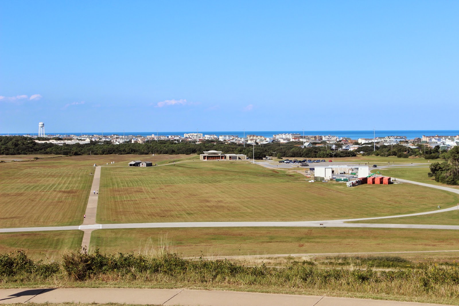
Kitty Hawk gave the Wright brothers the perfect open spot with reasonable winds to test the many designs for the wings of their gliders and the plane.

The gliders were launched from this hill called Kill Devil Hills, but the motorized plane was launched from the lower level surface with help from a rail launcher.


What a nice campground at Camp Hatteras in Wave, North Carolina.  This picture of one of about 30 kite boarders was right from our campsite.


A weather front was moving in and the winds were gusting from the 20's to 30 or more mph.


Not only a front row seat for the kite boarders, but also a great view for the sunset.

One of those sunsets that you just have to watch sizzle into the water.
We had mentioned about 30 kite boarders?  Of all of those, only 2 were able to get air time on their corners or jumping over waves.  This boarder is at least 10 feet above the water.  Sometimes he was able to get even higher.


From our campground, Jan and I did a nice drive all the way down to Hatteras Village.  To go further would have meant taking a ferry over to Ocracoke.

A nice stop near the village is Cape Hatteras Light Station


This is the tallest brick lighthouse in North America.  Like our Highland Light in Truro, Mass., this lighthouse was moved back from the beach in 1999. The Outer Banks are constantly changing with erosion and redeposited sand.


The light keepers house on the property has been converted into a very informative museum. One room is dedicated to pictures and a description of the 1999 move to the new location.

Another room gives a lot of information about the submarine threat off this coast in the early 1940's during World War II.  We never realized that during March and April of 1942, the German submarines were sinking about one merchant ship per day.!! Right off the coast of the Outer Banks.  One submarine wreck was just recently discovered and reported on the national news this week.

Heading away from the Outer Banks, Jan and I head over Route 64( not the interstate). The first part takes us over Roanoke Island.

These condominium owners seem to have a pretty great place to dock their boats.

Pretty nice boats!


State Route 64 follows the south side of Albermarle Sound and the Alligator River. This also includes the Intracoastal Waterway.

This route takes us on some  beautiful back roads as we head to our Corps of Engineer campground on the John Kerr Reservoir.

Along the way , we can see lots of activity in the many fields.  Lots and lots of cotton fields. Some being harvested and others already done.  These are two trailers of harvested cotton which are being compressed into large bales like the one covered in red.  We also passed fields of peanuts and large bins of harvested peanuts.  Not to mention, strange looking fields of what looked like green sticks with a few small leaves.  A local indicated that these were tobacco plants that had probably had most of the leaves harvested already.


When you are on a two lane road with a trailer truck behind you and everyone going about 60mph, you better not slow down too much.  Jan is great at taking the rolling side shots.

This is a small part of a large cotton field.


The above illustrates the advantages of travel away from the interstates.  Sometimes a bit more challenging, but often giving a much better idea of the area.

This leg of our adventure ends here at Rudds Creek COE Campground in Boydton, Virginia.  This is close to the North Carolina and Virginia border , west of Routes 95 and 85.

Sunday, October 19, 2014

Susquehanna River to Assateague Island


With heavy rain, Jan and I decided to spend a few extra days at Ives Run COE in Tioga, Pa.  Good choice, because the day we left gave us great views of fall foliage through the mountains as we traveled down Route 15 towards Harrisburg.


Route 15 joins up with the Susquehanna River and parallels it for a number of miles into Harrisburg.  We decided to try Ferry Campsites right on the river.  It is a Passport America campground which meant half price on a Thursday night.  The sunset over the river offered some great views.
We had been in this area six years ago, but further west on the Juniata River.  Just had to go back and catch some pictures from that visit.  Besides a side trip to Hershey, Pa, we had happened upon an antique car show. There is something about cars from your past.  This is a 1963 VW bug.
It had to be one of the most enjoyable , cheap drives at the time.  Jan's Dad had one a little older than this with the manual flip lever for the reserve gas. Ours was a 1968 model, still a lot of fun.
Also on show was a 1955 or 1956 Ford Thunderbird.  Clifton had one almost like this one.  Wish you still had it, Clifton?
And I just could not end without one of the ultimate cars of our 1950's neighborhood.  The 1957 Chevy was a classic for all time.  Enough said!
From the Susquehanna , it is quite a ride to head around Harrisburg and then east to Delaware.  The idea is to avoid all of the congestion of Washington, D.C. and Baltimore.  Well, we did avoid some of it by heading down Route 1 and then to the shore of Delaware and Henlopen State Park.  A beautiful park on the shore, it covers land once used by WWII installations used to keep track of enemy submarines and warships that might target war production faciliites in Wilmington.  This park is on Cape Henlopen in Delaware and right across the river is Cape May in New Jersey.  We could have come down the New Jersey shore to Cape May and then taken the ferry to Cape Henlopen.  We did see some large Class A and Fifth Wheel Rvs in line to board the ferry north.
Our main reason to head to this area was Assateague Island National Seashore Island Info.  And one of the biggest draws for this park is the presence of wild horses.  These pictures around our campsite are proof that the horses are very much there.
It's not just horses.  Assateague is a draw for beach goers, surfers, fishermen, and wildlife watchers.  Just to give you an idea of the popularity, we were lucky to get a camping spot here on a Saturday.  The sign going in said "Campground Full"  Luckily, we try to ignore such signs and check for ourselves.
The park is well kept and plenty of rangers and hosts working to keep it maintained.  This long walkway was recently replaced and provides a great views over the water on bayside.  

If you plan to visit, keep in mind that there are no hookups at this campground.  There is fresh water and a dump station within the campground.  For us, the solar panels came in handy once more and, of course, the entrance was free and the nightly cost was $10 with our senior pass. Keep in mind that  you can be in the wilderness here on the island and just a few miles north is a very busy tourist mecca called Ocean City.   But you will have no problem finding a crabshack for dinner.
This picture was taken from our back window.  The stallion was keeping track of three mares, but they were close by our RV most of the two days.  For those of you who are more familiar with horses, the rangers indicated that these horses may look a little bloated because they are always eating salty vegetation(including poison ivy!!) and for that reason, drink a lot of water. You can see that they are starting to get their winter coats.