
We could stay at Kartchner for longer and enjoy those great views, but we move on. South on Route 90 .
The view above greets us as we near Route 82.
The view above greets us as we near Route 82.

A right on Route 82 brings us some of these views. Many beautiful homes with acres of land.

There is the small town of Sonoita on the way.
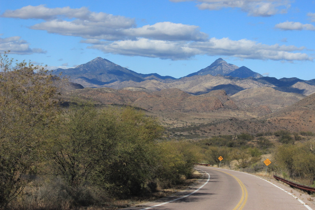
We start to see these views
We start to see these views

Getting closer to the town of Patagonia, Arizona.
Because of the lake and the large number of birds that visit, there are some well rated hotels and restaurants in the small town.
Because of the lake and the large number of birds that visit, there are some well rated hotels and restaurants in the small town.

Perhaps being close to the lake, but also because of the views there are some larger modern homes in the area.
Even coming into Patagonia State Park, the views demand your attention. Note how many homes are on those hills.(hint-none)

Jan and I always enjoy a good entrance sign.

There is a good hike by the side of the lake that usually rewards one with many sightings of birds and ducks.
Not an encouraging sign for small children and pets.
Not an encouraging sign for small children and pets.

The campground is a small campground, 72 sites.
As seen above , some of the sites are wonderful with good separation.
Website for Patagonia State Park-Wildlife Viewing page
As seen above , some of the sites are wonderful with good separation.
Website for Patagonia State Park-Wildlife Viewing page
The link above is for the state park and the Wildlife Viewing page.
The day we hiked the trail, the ranger at the visitors center indicated they had seen 49 different kinds of birds on the group hike in the morning. And this is a slower time of year until more birds return for nesting.
The day we hiked the trail, the ranger at the visitors center indicated they had seen 49 different kinds of birds on the group hike in the morning. And this is a slower time of year until more birds return for nesting.

Jan gives Patagonia a thumbs up for the views.

Kartchner Caverns was at 4700 foot elevation. Patagonia is at approximately 3700 foot elevation. The snow covered mountains in the distance are 7,000 to 9,000 feet.

Leaving Patagonia, we head south on Route 82 towards Nogales on the Mexican border.

Some of the recent snow has reached the lower elevations.

In Nogales we head north on Interstate 19 towards Tucson.
It is a common sight here to see homes built up on sides of the mountain, but not very far up.
It is a common sight here to see homes built up on sides of the mountain, but not very far up.

For visitors to the blog who have not seen a border patrol checkpoint, this is one on Route 19. Every car and truck must stop. There are a number of cameras taking your picture as you approach. The line today kept moving and we were waved through without even stopping.

Along the way is Green Valley, a fairly small town with many private homes, at least three golf courses, and an RV campground
The views east are of the Coronado National Forest and Mount Wrightson.
The views east are of the Coronado National Forest and Mount Wrightson.

Jan rejoices as we see our first Saguaros.

We had made backup plans because we thought our preferred destination of Gilbert Ray County Park Campground would be full before New Years Day. So, we were ecstatic when we found there were a number of great sites available when we arrived. This campground is in the Tucson Mountain Park near the Arizona Sonora Desert Museum and Old Tucson. Sites are $20 per night with electricity only. There is a dump station and water spigots. No reservations. Also , there are bathrooms, but no showers for those who require them. Payment is cash or checks. 7 day limit.
An Alltrails site on Gilbert Ray
An Alltrails site on Gilbert Ray

Had to take this one for Bailey. We explained it to the owner sitting in the back. What do you think Bailey?

Still haven't figured out why some Saguaros have more arms than others. Age is one reason, but we are still working on it.
 Jan volunteers as a marker to show how tall some of the saguaros can be.
 Gotta love this one .
See why?


See why?

Don't make fun of my nose!

A sunset view from Lady Blue's back window.

A little sunlight on the mountains. Some Teddy Bear cholla, creosote bushes, palo verde, and prickly pear cactus along with the saguaro.

And a bright Arizona sunset to end the day.
No comments:
Post a Comment