Translate

Friday, May 15, 2020

Parowan Gap Petroglyphs,BLM Land, Cedar City, Utah

This Monday will mark 3 weeks here at BLM Land above the Parowan Gap near Cedar City, Utah.  A number of people have visited here to look at the Petroglyphs.  You can almost read their minds, trying to place themselves almost 2,000 years ago.

The signage is great here, explaining the geography and Native American history.  200 million years ago the bedrock lifted up through the wind swept sand dunes that covered much of Utah. An ancient river flowed across the land. As the bedrock layers lifted, the river cut through them. Changing climate dried the river and the Gap became a Wind Gap.

Looking back from the north side , snow covered mountains, app. 10,000 feet or so.


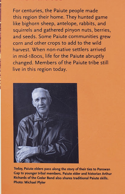
Indian tribes lived here for the past 12,000 years. However, the petroglyphs were created by the Paiutes around 500A.D. Interestingly , the symbols used were mostly universal to all Indian tribes throughout America.


Click Pictures to Enlarge
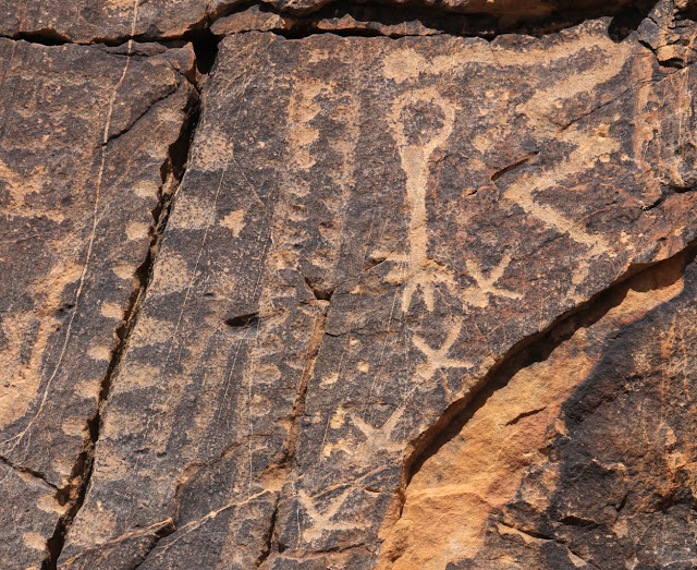
Above: Remember that the icon language was known to most tribes. The upside down bulb represents the leader , who is dead. The gray line represents the travel to this area( a crack in the rock) Other petroglyphs show the sun, the fields, rain and lack of rain, the seasons, and more.  Also, there are different interpretations , even by the experts.

For example: showing the Equinox, and multiple solstice. Showing the valley, narrows , and cairns ;rather than the head and neck.


One interpretation is three figures(upper left), another that they are the three moons of winter.


Before the water dried up for farming, note the abundance of wildlife. Including bighorn sheep, antelope, rabbits, and squirrels. Also , besides harvesting wild crops, they grew corn and other crops.


Some of the circular coils represented various tribes. This is sacred ground for the Paiute and Hopi.


The above crosses might represent birds in flight or tracks. The signs indicate that 
golden eagles, peregrine and prairie falcons, red tailed hawk, and great horned owls live here. We did see a large hawk on one of our hikes.


Seemingly tentatively balanced boulders at the Gap.

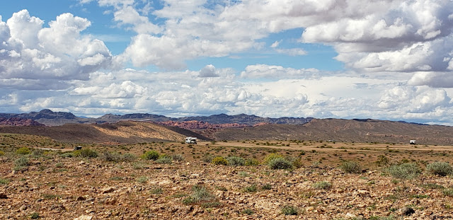
Jan on one of the dirt roads leading from the Gap.


Bruce on one of our hikes above the Gap.


Short video from a hike above our camping spot.


A different video from above our area.

Our version of Full Time Rver Social Distancing.


And while relaxing in Lady Blue, a family passes by on a horse ride. Looks like Dad and young son in front. Giving an extra horse some exercise on a lead, And perhaps a daughter on her own horse.

Thursday, April 30, 2020

Snowbird Mesa, Overton, Nevada; Interstate 15 north into Utah, Parowan Gap BLM land, Cedar City, Utah


Above is our spot at Snowbird Mesa in Overton, Nevada; just a few miles up the road from Valley of Fire State Park(which is closed for Covid19).  

We were here for 32 days. As many of you fully realize, the parameters of the Covid19 shutdowns kept changing almost daily. It became suggested and expected that customers would wear masks in the stores, so Jan and I looked up how to fold a mask. Jan's was from a dishtowel(note butterflies) and mine (not shown) was from a blue bandana.  Being fulltime RVers, we do not have an option(out here on BLM land) of food delivery, UPS,Fedex,etc. So we have to mingle with other people at a dump station, propane station, grocery store, and laundry. Luckily Overton was a small town and had no Covid 19 cases(as far as anyone knew)while we were there.

A bonus of our stay was being ably to catch Prickly Pear blossoms and other plants as well.

These tiny flowers pop up among the rocks. The blossoms are smaller than a dime.

Not sure of the name, but this plant has a sage like color with beautiful blue/purple flowers. Could be a variation of Schott's Dalea or a Lupine.

Look close!!!
The little guy--about 5 to 7 inches long is a Horned Lizard. We would see a number of these every day, but only after they moved. They would blend perfectly with the rocks and seemed to be like chameleons in adjusting their own color.
Southern Desert Horned Lizards

The plant above we thought was definitely an alien from outer space or a 1960's sci-fi movie.  But it is a Desert Trumpet.
Very strange!

This picture is taken from our longer walk over on Poverty Flats Mesa. You can see that Lady Blue is being very conscientious about Social Distancing.

It was a beautiful clear evening for the Supermoon on April 7th.
With the RVs at the bottom of the picture, you have an idea how large it seemed in Nevada.

32 days on Snowbird Mesa. The first few weeks were quite pleasant with cool evenings and days in the 70's or low 80's and about 7 to 12 per cent humidity. Some heavy showers would pop up and some very,very strong winds(50 to 60mph) But then around April 20th, it started to get much warmer. By April 24th, we were looking at temps close to 100 degrees and staying fairly warm at night. When we saw a forecast for April 29th of 103 to 105 degrees, we decided it was time to try to find another place.  Remember that we are boondocking on the mesa--no electricity, sewer, or water. We had a great 4000 watt generator on board, but you do not want to run it all day and night.  So we checked and saw a possibility of BLM land northwest of Cedar City, Utah at the Parowan Gap Petroglyphs. The elevation at Snowbird Mesa in Overton was around 1200 feet and the elevation at the Petroglyphs is 5500 feet. The difference in the temperature forecast is a comfy mid 80's for April 29 versus 103 degrees for Overton. We decided to try it. We head north out of Overton on Route 169 and then north on Interstate 15. It does not take long to begin a climb(in a small northwest section of Arizona).

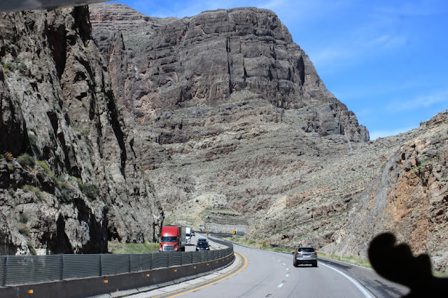
Another scenic highway in the west, cutting through some rugged mountains.

We see that this road follows the Virgin River and the Virgin River Recreation Area. You can see the muddy brown river below.
Virgin River Recreation Area info via Trip Advisor
Note that the above link was through Trip Advisor which gave us a number of beautiful pictures. Try another search if it does not work for you. if you sign up for Trip Advisor you will get emails.


Beginning to see some of the red rock associated with Utah.

This part of the highway easily follows the river and valley created over thousands of years ago.

In Utah, we begin to see natural grasslands, Juniper trees and snow covered mountains ranging from 6700 feet to 11,300 feet.

A number of stops have been necessary, including dumping tanks, filling with water and propane, and also some grocery shopping. Eventually we reach Cedar City, happily fill with much less expensive gas($2.12 per gallon) and head out on Route 130 towards the Gap.

Thousands of years and an ancient river cut through the rock here. The river dried up, but the petroglyphs are still here.  Pictures coming in the next blog.


Lady Blue is quite happy with her new spot!

The view above us includes a picturesque hiking/atv road, and views of the high snow cover mountains.

Much happier with 70's and 80's weather. The nights drop into the 40's but quickly warm up to the 60's in the morning. When it was 105 degrees in Overton, Nevada, we had mid 80's here and then cooling nicely overnight.  Ahead the forecast is low to mid 70's which is fine with us!  Still trying to find out what our plan might be for May and June. Alison sent us a link for Maine that indicates strict closures into May and 14 day self quarantine for all of June. The restrictions on private campgrounds are still not clear and state park openings are still not clear. Same still for New Hampshire and Massachusetts and Rhode Island and Connecticut.  

Many miles available to hike! And all with beautiful Utah views.


Friday, April 3, 2020

Snowbird Mesa, BLM Land, Overton,Nevada

The Prickly Pear Cactus were beginning to blossom before we left Katherine Landing  Campground in Lake Mead National Recreation Area.
When we published the last issue on March 21st, we were understanding that we could stay there for another 30 days. Well----a few days later there was a leaflet on our windshield(and everyone else's windshield)that we had to leave within 24 hours.  Thanks for the advance notice-not.  The workers in the park totally understood. It was a dry camping spot.  There were bathroom cleaners, but no other maintenance needed.  The directive , of course, was from the National office. Felt bad for the workers because they received the same notice as a layoff happening immediately.
Everyone in the campground was scrambling to decide where to head and what campground might be open.  We decided to head to BLM land above Valley of Fire State Park in Nevada. The state park was closed, but the dump station and water were supposed to stay open.

Meanwhile---a great view from our window at Katherine Landing.


In the parking lot and driving around the area was this 1956 Morris Minor 1000.  Rarely see any of these.


This is a web picture of a 1956 Morris Minor 1000 , two door traveller.  For sale for about $16,500.


A picture from the Marina dock . The campground is a ways behind the trees.


We actually got more than 24 hours. We were leaving the next day and a camper let us know that they were allowing campers a few days to make plans and then everyone was out.  We did go to the office to get our one day refund. But when the office was closed, we decided we would stay one more day.


Such a simple move to head west and north on small roads to the BLM spot.  Not so simple. They had the road closed that went through Lake Mead Recreation Area(west shore) Route 167. So, of course, we had to backtrack and drive through Las Vegas on Route 515 to Interstate 15 north.  A few glimpses of the strip and the Stratosphere Pod above.  Stay at home was in place for Las Vegas, but you couldn't tell from the number of vehicles on the road.


Ah-h-h-!
We. find a wonderful spot on the BLM Land, Snowbird Mesa, just south of Overton, Nevada. About 50 miles north of Las Vegas . Our trip turned out to be about 200 miles.
The BLM land is huge here. Room for more than 100 RVs. Nowhere near that many, probably because of the Covid 19 shutdowns.  There is no water, electric, dump station, or bathrooms here. And the cost is zero.  We called when we arrived, to Valley of Fire State Park and they said the dump station and water were open. Cost would be $10. So, we thought we were good until we knew what was happening in camping.  We already knew that our Escapee membership parks were full and not taking any new campers. Corps of Engineer Parks were closed. National Parks were closed. And many State parks were closed for camping as well.


One for Bailey. A Westfalia on the edge of the Mesa with a snow covered mountain for a view. Not too bad?


A picture with the Canon out our window of the snow covered mountain. The mountains mean that clouds can gather quickly and be quite dark at times.  Rain too.


Jan is enjoying our walk over to Poverty Flats Mesa.  A good deal of walking area here. This Mesa is also not full.


The video above is from Snowbird Mesa. At the beginning you can see the small town of Overton in the distance.


The small plants are beginning to blossom.


The video above is from Poverty Flats Mesa.  The separation between RVs is huge. A good thing for Covid19 protection.
Unfortunately, as fulltime campers, it is necessary to make trips to the grocery store, a dump station, a laundry, and a gas station.
Speaking of dump stations. we headed out at our normal interval to use the dump station at Valley of Fire.  The road was closed!  Thanks for that update too.  Yes, we were told by the park that it was going to be open. But, we guess, the state decided that it had to be closed. Luckily , a local RV repair owner found out about that and posted a note at the BLM land that they were available to offer their dump station and water in Overton. They posted the note on that same day that we needed it.  They were very nice . Cal's Repair Center in Overton, Nevada. The wife was on the town board and had argued that RVers on the Mesas would have no way to empty or have water.  They were not listening , so she opened their business dump station. The alternative was a 60 mile trip .  She was going to try to convince the state to reopen the park dump station.  We are so thankful!
As of now, 40 of the 52 states have closed their state parks to camping. Utah, for instance, has state park campgrounds open, but only for local residents. Some KOA campgrounds are either closed or limiting a one night stay. National Park campgrounds and National Forest campgrounds are mostly closed. Private campgrounds that we have contacted so far, are reluctant to have RVers stop in because they are afraid of the Covid19 virus.
In a sense, we fulltime campers , are now a pariah of sorts to the campground industry.  Hopefully we can stay here until May 1st at least and then see what is available.
Sheltering in place is okay for us, but we do need a spot to be able to shelter in place.
We thank many of you for signing on to that petition to keep parks open. As you might realize, that petition died with the national and state closures. 
There are over one million fulltme RVers. Hopefully, they have found places to be.


Yes!! This is a real picture with our Canon.  It suddenly appeared and we had just enough time to grab the camera. The sun was setting behind us--not behind the mountain.  The light was catching in the clouds and highlighting the snow covered mountaintop. The kind of picture you just cannot plan.


A little gift to end this blog.  
If you are looking for a video to take up time during the Covid19 isolation.  This gentleman has a number of videos. This log cabin took about a year to  build and the video is fairly long(not a year). His name is Shawn James of My Self Reliance and his videos are on Youtube.  The build is done alone, without power tools , and over the span of a year in 1917.
Anyone for building a log cabin???